Projects / Glaciers, hydropower and climate change in West Greenland
Glaciers, hydropower and climate change in West Greenland
Ground-based SfM photogrammetry and ground-penetrating radar used to measure ice volume and 29-year mass loss of a small valley glacier on Greenland's west coast.
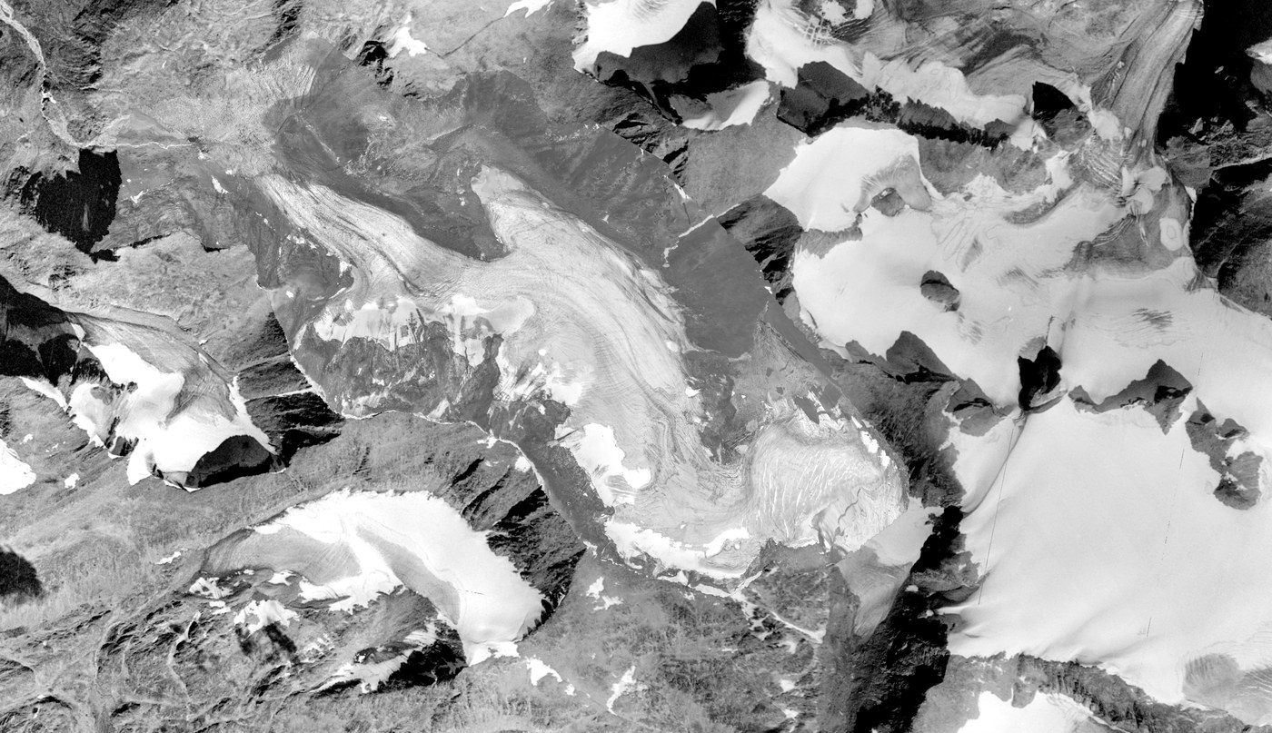
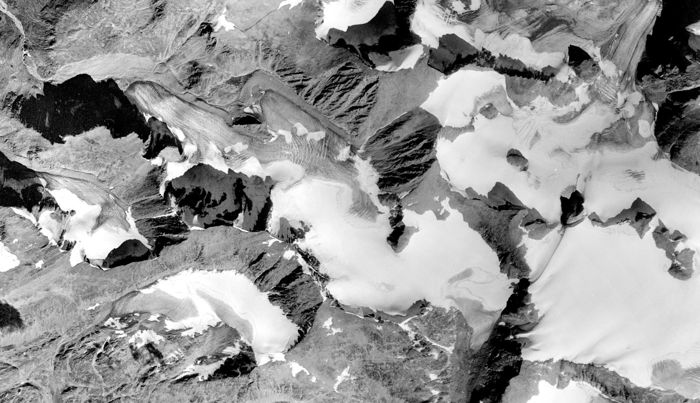
Aqqutikitsoq glacier orthophotos from 1985 (aerial) and 2014 (SfM). The glacier front has retreated roughly 1.2 km since the Little Ice Age maximum. Drag to compare.
Context
Lake Tasersuaq, a few kilometres downstream of Aqqutikitsoq, feeds the hydropower plant that supplies electricity to Sisimiut, the second-largest town in Greenland. The region sits in a precipitation shadow and is considerably drier than the coast, so glacier meltwater contributes a meaningful fraction of total summer discharge into the reservoir. Understanding how this glacier cluster is changing matters for long-term energy planning.
Aqqutikitsoq (2.85 km², ~27 km northeast of Sisimiut) sits within a cluster of roughly 100 glaciers in the Sisimiut area covering ~85 km². It was chosen as a representative study glacier for this cluster. At the time of the study it was also the first glacier on Greenland's west coast with both a detailed ice thickness survey and a multi-decadal geodetic mass balance record.
Approach
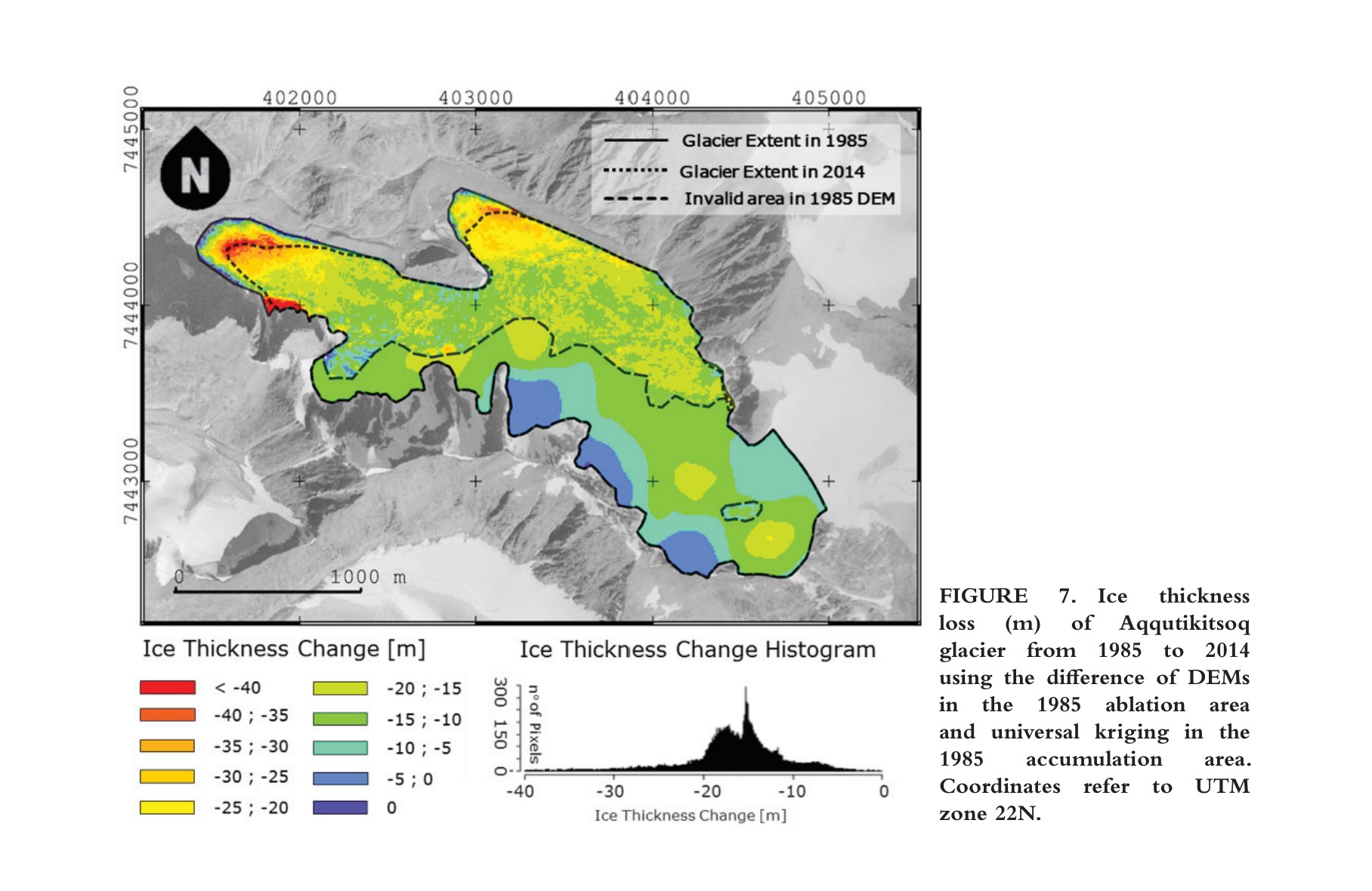
With no drone available, 622 photographs were taken from four mountain peaks flanking the glacier using two consumer cameras, together with 138 GPS-surveyed ground control points. The resulting 2014 SfM DEM (0.73 m native resolution) was differenced against a 1985 DEM derived from aerial photographs to compute surface elevation change. In parallel, 37 ground-penetrating radar (GPR) profiles totalling 18.5 km gave the 2014 ice thickness distribution.
Results
From 1985 to 2014 the glacier lost 49.8 ± 9.4 million m³, roughly a quarter of its 1985 volume, at a mean thinning rate of 0.60 ± 0.11 m/yr. This is comparable to the geodetic mass balance of Swiss Alpine glaciers over a similar period. Total ice volume in 2014 was 148.6 ± 47.7 million m³, with a maximum depth of 174 m. The ice thickness data were later used as one of 18 reference glaciers in the ITMIX global ice thickness model intercomparison exercise.
Publications
Three Decades of Volume Change of a Small Greenlandic Glacier Using Ground Penetrating Radar, Structure from Motion, and Aerial Photogrammetry
Marcer, Stentoft, Bjerre, Cimoli, Bjørk, Stenseng, Machguth · Arctic, Antarctic, and Alpine Research · 49(3), 411-425 · 2017
doi:10.1657/AAAR0016-049